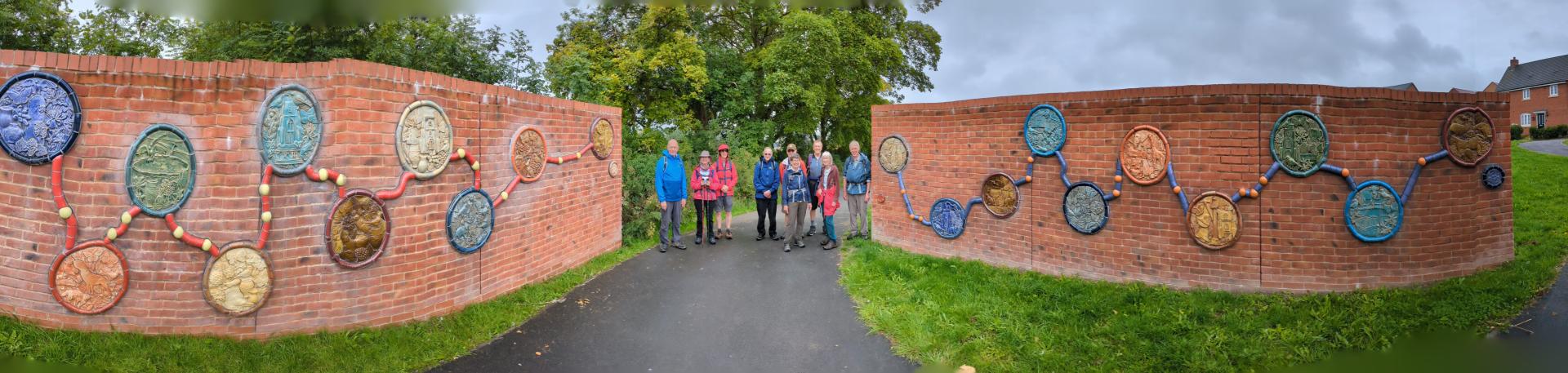
Trail Walkers

LALG Trail Walkers Group We aim to cover some of the longer distance trails that pass near Letchworth.  We normally walk on the second Tuesday of every month, but occasionally do two walks in the month.  The average walk is 10-12 miles.  We share cars for these linear walks. New members are warmly welcome.  

We started the John Bunyan Trail in October and are due to complete this trail in June.  Keep an eye on our page on the LALG website for details of an exciting new walking trail which we are planning.

If you may be interested in joining us or have any questions, please get in touch with Nigel B, the Group Contact via trailwalkers@lalg.org.uk.

Safety Information: Walking

Contact Details

Minsden Chapel nr Preston

Group Events

Tuesday 9 June 2026, 9:30am
Tuesday 14 July 2026, 9:30am

Group Articles

Find an article quickly

The Trail, described from South to North, begins at Sundon Country Park (GR 048287) on the beautiful Chiltern Hills, which are reputed to be John Bunyan's 'delectable mountains'.
Today's Pilgrims setting out on this trail will pass through some of Bedfordshire's most attractive and scenic countryside. They will also experience a variety of nostalgic places, full of interest and intrigue, connected with John Bunyan. Some of these places are associated with his travels as a tinker, while others are believed to be meeting places where he would preach - in contravention of laws then
governing England.

He was imprisoned twice as a result of his non-attendance at the established church and for his illegal preaching: Firstly, from 1660 for 12 years, in Bedford County Gaol; Then, secondly, in 1675 for six months - probably in Bedford Town Jail, which is where he began writing his world-famous book, The Pilgrim's Progress, an allegory of Bunyan's own spiritual journey. The book incorporates many local places, including Houghton House near Ampthill ('House Beautiful') - which John would have visited whilst plying his trade of Tinker.


Having now reached Elstow Green, modern pilgrims who are intent on learning about this legendary Puritan Evangelist, should visit the Moot Hall and Abbey Church. And then journey north on the trail to visit Bunyan Meeting Church and Museum in Mill Street, Bedford.

A circular walk along the Ayot Greenway and by the River Lea before returning through Brocket Park and followed by a Christmas lunch at the Red Lion pub nearby. 

In 2024 we completed the Icknield Way Path, which may be the oldest road in England, and which runs from Ivinghoe Beacon, through Letchworth Garden City and into Cambridgeshire and ultimately Norfolk.

It was a windy and wet Spring day when we started the Icknield Way Path, walking up Ivinghoe Beacon, from its junction with the ancient Ridgeway. Normally we would have had extensive views as we walked along the ridge of Dunstable Downs. But the gliders were all tethered down and even a kite flyer would have risked losing control.

Fortunately, subsequent sections of the walk enjoyed better weather. It is difficult to avoid the new housebuilding in Bedfordshire, but the path skirts round, or, in some cases, on well-landscaped routes through, the estates. Once in Hertfordshire, sections of the Icknield Way are shared with the Chiltern Way, which we covered the previous year. But you never tire of the tramp up Telegraph Hill, with the old lane worn down by centuries of horses and carts.

The origins of the Icknield Way are lost in the mists of time, but it is thought to date back to
Neolithic times. Whether it is linked to the Iceni tribe, ruled by Queen Boudicca, is more speculative. It was a trade route, linking East Anglia to Berkshire and Wiltshire, although the modern path does not extend so far west. Some roads, including through Letchworth, have subsumed the route of the old path, and walkers are diverted off it at times.

The landscape changed as we walked further north and east into Cambridgeshire and Suffolk, although we never had a flat walking day. As we neared the end, at Knettishall Heath, where the Peddars Way continues on to the Norfolk coast, we had a few lengthy legs in order to finish the walk before the clocks changed, staying overnight to cover the last two on concurrent days.

The Chiltern Way is a long distance path, supervised by the Chiltern Society, which extends from around Hitchin to the north east to Goring near Reading in the south west. It is a “circular” walk of nearly 200 miles in total, although it looks a pretty squashed oval shape on a map. While it would have been lovely to have walked the entire route, it wasn’t practicable on day walks from North Hertfordshire to cover the southern sections.

So from March to August 2023 we walked the northern sections. We started at Barton-le-Clay and walked in a clockwise direction around the Chiltern Way to Flamstead. From there we cut across to rejoin the Chiltern Way near Ashridge Forest and finished up at Sharpenhoe Clappers.  
In September ten of us undertook two circular walks, cleverly created by our walk leader, Chris, along some southern sections of the Chiltern Way, staying overnight near Stokenchurch. The terrain was quite different from the northern Chilterns - dry valley bottoms, with much steeper hills, and a great deal of woodland. The villages were frequently picturesque, including the “Vicar of Dibley” village of Turville with the “Chitty Chitty Bang Bang” windmill at Cobstone on the hill above.

We started the Hertfordshire Way in Little Wymondley in September 2021 in pouring rain, and finished there in December 2022 in deep snow and heavy frost!  In between (and, to be fair, on most occasions) we have had beautiful sunny skies.  The LALG Trailwalkers group started with 8 walkers for that first leg and finished the last leg with 14.  

We’ve enjoyed a wide variety of landscapes: chalk downs around Royston, ploughed clay fields (probably not our favourite) in the east of the county, delightful riverscapes along the New River and the Lea, many picturesque villages throughout the county, even when close to the M25.  Although we take a picnic lunch to save time, there have been a few pubs handily located for liquid refreshment near the end of a walk.  We have been grateful to the many parish churches whose porches have accommodated us on the less clement days.  Wildlife, including birds and deer, and the varying wild flowers and treescape over the seasons have been an important part of our walking, as well as the craik. History has been evident  everywhere:  long barrows, ancient fishponds, stone crosses.

With 195 miles behind us, taken in monthly stages of 12-15 miles, sharing cars, we are eager to start our next adventure, the Chiltern Way, in March.  New walkers would be welcome. 

Anyone for “tennish”

The LALG trailwalkers meet again – Our eighth leg of the Hertfordshire Way was on Tuesday 9 May.  It is Leg 10a (hence it is “tennish”), not the sport that requires new balls please for this walk. Chris once again led the walk, for this stage a mere half dozen of us. Being mid-May there was the potential for precipitation, it was a light drizzle as we began our walk, but was a pleasant temperature for walking the 12.5 miles or so planned.

The route takes us from Broxbourne to Cuffley, starting at the bottom of Mill Lane in Broxbourne, going along beside the New River and then plunging in to Hertfordshire’s only National Nature Reserve, for a great deal of the walk. We will walk through four tightly knit but separately named woods that comprise Broxbourne Woods National Nature Reserve. There is really something special about our native woodland. In this case the tree canopy is spectacular in mid Spring, the forest (which it really is) provides a host for all types of fauna and flora with woodpeckers working hard on the tress, and many native and visiting birds flittering busily amongst the trees.  

The woods are said to have been in this area since the last great ice age, over 10,000 years ago, so are very precious, in places though the vegetation is very tight, with the path disappearing in to thick brush, which added to a ferocious cloudburst, got us all pretty wet from head to toe. Fortunately, with Ken and Chris as our guides and the trusty Hertfordshire Way roundels being in place. Although the footpaths and bridleways meander through the woods/forest, seemingly randomly in what is by nature, an unchanging landscape, we only missed our route once, giving us perhaps an extra mile for the day!

As always, once one becomes unclear as to where the route heads, do not trust to luck and carry on charging along a possibly incorrect route on an enticing path that looks as if it may be going in the correct direction.  Do as we did, retrace your steps and stop to look around to pinpoint the correct logical roundel. Trouble is there are many roundels for separate trails which seek to bewilder the innocent walker to switch direction. We found the correct roundel and plunged deeper in to the woods on our way. This made us consider that we were all Forest bathing -This Japanese practice is a process of relaxation; known in Japan as shinrin yoku. The simple method of being calm and quiet amongst the trees, observing nature around you whilst breathing deeply can help both adults and children de-stress and boost health and wellbeing in a natural way. Forest bathing is great for teaching concentration and mindfulness; whilst also providing an excellent opportunity to learn from each other. We recommend it to all who read this article.

Whilst in the wood, we come across a solitary coal post in the middle of the wood, repainted and well maintained. On asking I am told – it is that duty once had to be paid on coal and wine from the London ports to help finance the rebuilding of the capital after the Great Fire of 1666, there were something like 288 of them, at each entry/exit point to London.

We leave the forest, wander through scrubby fields that match natural landscapes from 1000 years ago. Go through Goffs Oak, reached via the delightfully named “Bread and Cheese Lane. Along road side footpaths and down a very narrow path with lots of stinging nettles, shorts not such a good idea here! Then across open farmland towards Cuffley viaduct, chased along a broad track by giant tractors towing silage trailers. We then walk under the viaduct into Cuffley to the Car Park, ready to complete another fine day of walking in Hertfordshire. Thanks again to Chris and Ken, our ever reliable, cheerful guides.

To do 10b

The LALG trailwalkers met again to continue our goal of walking the Hertfordshire Way, piece by piece. Our seventh leg of the Hertfordshire Way was on Tuesday 12 April.  It was Leg 10b, as shown in the Friends of Hertfordshire Way guide, as we are going the “wrong way round” it goes from Hertford to Broxbourne 

Chris as usual led the walk.  We were trusting the weather gods would look upon us kindly, as there was the potential for rain, however it didn’t appear until we were within 5 minutes of completing the stage. It was a shorts day for some us!

The route for today starts by crossing the River Beane, the River Rib, then tracks along the River Lea, walking along the towpath, (the River Lea was “canalised” to make it more navigable), chasing narrowboats on the way to Ware. Here we discovered a unique claim to fame. Nowhere else in Britain can you find so many gazebos along a single stretch of river. On a little post walk investigation, it seems that their origins can be traced back to their construction in the 18th and early 19th centuries. A rare few are thought to date from the late 1600s. They were apparently built by innkeepers and other owners of property on the high street as eccentric but peaceful places to meditate, paint and entertain guests to act as a haven from their busy lives in town. There is an information board showing that during the 1980s East Herts District Council, the Ware Society and other sponsors paid to restore them, they are remarkable and truly worth checking-out.

Some more research from “the web” points out that “the Lea Valley was for years the industrial centre of London and home to many inventions including the first monorail (horse drawn), the driving power behind the motorcycle industry, the great railway works, buses, guns, gunpowder, chemicals, shipbuilding and, after the invention of the diode in Ponders End in 1904, the UK’s first “silicon valley”.

Onwards along the river past Amwell Nature Reserve the reserve includes a mosaic of lakes, rivers, grasslands and woodlands. In 1991 six otters were released at the reserve and have bred, and now have moved to other sites in the county. The reserve, is also home to bitterns, great crested grebes and important numbers of wintering wildfowl. We saw some wildfowl, but no otters nor did we hear the booming call of the bittern.

Onwards again, to another change of scenery, through seemingly hundreds of rolling acres of arable land into the stunning Ash Valley. Back to the River, but this time the “New River“. The New River is an artificial waterway which opened in 1613 to supply London with fresh drinking water taken from the River Lea along with other springs and wells along its 20-mile course from Ware and Hertford to Stoke Newington. The New River relies on gravity to allow the water to flow carefully following the contours of the terrain from near Hertford into London, meaning it drops just five inches per mile. The New River, still supplies eight per cent of London’s water.

Then to Broxbourne, dashing through the April Showers to return to Letchworth, content with a fantastic day of walking in great company.

JB


Back on the trail

We are back and walking again, a dozen Trailwalkers met on the 8th March to continue our route around the Hertfordshire way. As reported earlier, we are doing the trail “the wrong way round”, so this day we went from Widford in to Hertford.  This stage takes in 3 different rivers, tributaries of the River Lea, the Beane, Rib and Ash to eventually meet-up with the River Lea itself in Hertford.

The day dawned with beautiful crisp and clear early spring sunshine, portents of a great day for country walking. We started at a lay-by, close to Widford church moving in to the beautiful Ash valley towards Wareside. Kites and buzzards were soaring and keening, whilst the hedgerow birds flittered in and out of their hidey holes, carrying nesting material, spring had clearly arrived.  The route took in Cold Christmas, Thundridge, Wadesmill, Tonwell, Stapleford and on to Hertford, for a total of close to 14 miles.

The countryside on this stage is mostly river valleys and woodland, it is very pretty and in the spring sunshine looked glorious as snowdrops and daffodils were blooming. The bluebells will be spectacular in another month or so, this walk is well worth a day of anyone’s time. With estate grounds to pass through, most notably the Woodhall Estate and Heath Mount School, we had some minor challenges, climbing the wall (legally) via different stiles and with alternative styles of climbing generated many giggles from the team. 

As we approached Hertford, the evidence of agriculture, industrialisation and brewing became more prevalent. Sluice gates, locks, warehouse and oast-house buildings alongside the path, beautiful in their own way. The industrial management of the River Lea became more evident such that the banks are contained with the remnants of wharfs in place for offloading, in their heyday, barley and other cereals, for the brewers in Hertford and all along the river down to London. We had a memorable sit-down “tea-break” in a church-yard, where the ground maintenance volunteer pointed out a sun dial to us on the church door, it was remarkably accurate. 12 quite tired but very happy walkers strolled in to Hertford, for the return journey(s) home, discussion on ensuring that a Pub is available at the end of the next trail was had, we’ll see!

JB

Sculptures, Georgian Splendour and Tapestry

Eight intrepid walkers set off on a brisk February day from Bishops Stortford hoping the mud would be kind to us today. The walk started along the banks of the River Stort, skirting Waytemore Castle mound and then heading through the town centre and then playing fields westwards.

Once we had negotiated an edge of town housing estate and a flooded subway we were out in the wide open countryside of East Hertfordshire.  The next three miles were along field edges and beside streams and woods – not too muddy – until we reached the hamlets of Dane Bridge and Green Tye.

The next hamlet was Perry Green: famous as the home of Henry Moore who moved there to escape wartime bombing in London and lived there until his death in 1986. The route takes us through the sculpture garden where there are powerful works of art, some of mammoth size.

Then down into the valley of the River Ash, past pretty Sidehill Wood and then a circuit of Much Hadham. It is said this one of the most beautiful villages in Hertfordshire with many and varied architectural styles of Georgian houses and cottages along the High Street. An important place as the Bishops of London had a Palace here.

A visit to Much Hadham church revealed the skill of the local tapestry experts – many, many beautiful kneelers on display.

It was then back to the River Ash which was followed southwards through woods and meadows all the way to Widford. 13 miles in all with the weather staying kind.  

Big Skies, Big Fields

Our walk on Tuesday, 7 November saw 9 of us head off on Leg 13 of the Hertfordshire Way, from Hare Street to Bishop’s Stortford.  We were joined by new member Ann.

As we set off the weather looked promising and after walking through the first few fields we were soon at Little Hormead.  We passed by St Mary the Virgin Church and unlike previous walks, we were unable to explore this Grade 1 Listed 11th Century redundant building as it was shrouded with scaffolding and plastic.

We were soon walking across farmland and were treated to fantastic views across large ploughed arable fields.  It was a day of big fields and big blue skies and it wasn’t long before several walkers needed to remove a layer or two of clothing.  We walked on a little before finding a sunny spot for our first stop and a quick coffee break.

Walking on a few more miles, we arrived at Gravesend passing The Catherine Wheel pub, then on to Patmore Heath.  Chris suggested we made use of one of the only benches spotted on this walk and we took an early lunch break sitting in the sun.  Patmore Heath is a Site of Special Scientific Interest, probably the best remaining example of grass heath in Hertfordshire – a scarce habitat in south east England.  Herts and Middlesex Trust describe the heath as being is typified by wavy hair grass, red and sheep’s fescue grasses and sweet vernal grass, with characteristic summer flowers such as heath bedstraw and sheep’s sorrel. In damper areas the locally rare heath rush and southern marsh orchid can be found. The ponds support all three native newts, including the locally-rare palmate newt, plus plants such as creeping jenny and lesser spearwort.

Fortified, we walked on to Upwick Green passing the odd pretty cottage on the way.  Much of the day was spent in open countryside only passing occasional habitation and few roads to cross.

Across fields once again, we soon arrived at the new bridge across the bypass currently under construction and stopped to take a few photos of the group and watch the workers on the road below. 

Arriving at Hadham Hall was a spectacular sight.  Looking at the 16th Century Hall it is amazing to think of settlements having been on the site since around 53BC when one of the Belgic tribes that led Celtic resistance to Julius Caesar’s invasion arrived in the area.  Coming through the gatehouse, we passed a large piece of Hertfordshire pudding stone. The footpath went on to follow the edge of an L-shaped pond, possibly the remains of one of the original fish ponds. 

The last 45 minutes or so of the walk were the most suburban after a full day mostly off road in open countryside. We walked through the streets of Bishop’s Stortford to end our walk at Grange Paddocks Car Park.

AB

A tale of four churches

Logistics are now more complex, we have multiple cars to each point, so that we can all start from the same location, finish at the same location and then be transported appropriately back to our scattered locations in and around Letchworth and Hitchin, NB does a fantastic job in ensuring this all works as it needs to.

Stage 3 goes from Royston to Hare Street, with a couple of surprisingly long climbs, past open farmland on chalk hills with a shoot being run as the driven birds scurried and flew past us, with all of us cheering them on to escape the guns! We go via Reed (church 1); Barkway (church 2); Nuthamstead; Anstey (church 3); Great Hormead (church 4) thence to Hare Street.

What really strikes anyone walking in this part of Hertfordshire are the amazing Churches, nearly all utilising flint in their construction, some with evidence of late Saxon architecture, Norman naves and big, solid Towers – showing how many a Church was also a fort in those challenging times, a place of worship and sanctuary as well as a place of last resort, the Church theme continues through this stage of our walk.

Beautiful Barkway provided delights for all the senses, a place of fine buildings, delightful walkways and reasons to return for a better look around in the future.

Evidence of Henry VIII’s ravages and of more modern times, with memorials to all our local fallen. Nuthamstead provides serious food for thought, with the remnants of a major fighter and bomber airfield and a museum on site, with memorials in honour of all who were based, lived and were lost from within our County back in 1943 – 45.

In this month of all months, Lest we Forget…

Lunch had us in the porch of the Church at Anstey, cover and a seat greatly appreciated by all of us. Halloween being just around the corner in 5 days, the sight of 4 skeletons, sitting around an outdoor table, pints close to hand, whilst a dog skeleton “barked” next to them and a cat skeleton sought refuge on the windowsill provided light relief the pub looked great, a Free House, note to selves to return and check it out.

We completed this stage by arriving in Hare Street. The last two stages totalling approximately 26 miles - what a great route to perhaps use as a “Hertfordshire Marathon”. Whilst we saw plenty of different crops, Fennel was not among them, so perhaps not?

JB


In the footsteps of our ancestors

The intrepid LALG trailwalkers group are continuing the process of walking the Hertfordshire Way (a bit like walking versions of Ewan & Charlie, we are doing the walk “the wrong way round”).

Our stage 2 which is a reverse of leg 1 in 'The Hertfordshire Way' guidebook takes us from Wallington to Royston.

Firstly out of Wallington, past the Farm that is said to be the one that inspired Eric Arthur Blair when he wrote “Animal Farm”. Through a field with very large cattle present thence to Sandon, Kelshall and Therfield, over the heath, a climb up to view all the way to Ely, then on to Royston.

Lady Roisia raised a cross here in the middle ages, marking where two ancient roads crossed - the Icknield Way and Ermine Street. The place become known as Roisia’s Cross, then Roisia’s tun or town, and eventually Royston. The stone that held the cross is called the “Roye Stone” and is at the crossroads.

This part of Hertfordshire is glorious, a mix of open fields, beautiful woodland (great for “wood bathing”) and across spectacular heathland with rolling chalk downland. Whilst walking across open fields, in rolling countryside, we spotted a large herd of Fallow Deer, although we were about 400m or so from them, they were very wary, spotted us and trotted in to “dead ground” to stay hidden. As we continued on though, they appeared again, and within the herd were 2 or 3 “White Harts”, an exciting moment for all of us.  White Deer hold a place in the traditions of many cultures, vestiges of that still remain as we were all entranced by the site of such beautiful, large wild animals living in their own way so close to us in our busy, bustling County.

Lunch was taken on the green at Therfield, with joy of joys for all long distance walkers, facilities available and open behind the local Pub, (those who walk will understand how delightful that is).

On Therfield Heath, is Hertfordshire’s oldest Barrow, over 5000 years old, there is evidence of our Iron Age ancestors. The Yorkist Army is said to have mustered here before the first Battle of St Albans during the Wars of the Roses. Now a golf course and gallops along with special areas where flowers grow and foxes frolic in their covert are testament to a more peaceful environment. 

We trod along elements of the Icknield Way, a route that has been in existence since at least AD 903, it is not hard to imagine the 40 or more generations of people who have also walked this way, as pilgrims, itinerant workers, soldiers or families seeking new opportunities, history is all around us. 


The rain it raineth…

The recently re-started LALG trailwalkers group have managed 3 walks in utterly glorious weather, over the past few months. It had to change I suppose. My goodness it did, Tuesday 14th September dawned wet, very, very wet, so wet; that apparently a month’s rain fell in the one day.

Suffice to say, 8 trailwalkers met at Little Wymondley, for 09:45 and put on full wet weather gear (it can’t be called waterproofs, as in this case, over the walk no-one remained dry, the challenge was too great for even the best gear) ready to head off on our first leg of the Hertfordshire Way.

The Hertfordshire Way is a 195-mile circular route. The map below shows the route and the sections to be walked over the course of the next year. We were heading the “wrong way round” starting at section 2, Little Wymondley to Wallington as this is within easy reach of Letchworth Garden City. Chris was our guide once again, with Ken, from the “Friends of Hertfordshire Way” joining us and also guiding.

Before we set off, we congregated in the road for a group snap, thanks so much to the floor covering van driver who pulled-up on the junction and took a snap, hanging out of his window, not leaving the warm/dry van (I did say it was very, very wet). The route takes us under the A1M, (underpass for a break from the rain) to Graveley, then through "Forster Country" to Weston past very soggy Alpacas in the fields, using the Churchyard for lunch. Thanks to Weston Church for having a large, open and dry porch, in which we sought sanctuary from the incessant downpour and were able to consume our lunch in the dry.

In the churchyard is the famous grave of the local giant Jack-o-Legs. The legend states that he was a ruthless robber of travellers, when the men of Baldock finally caught him near their town, before they slew him (no trial for him when caught in the act) They granted his request that they would bury him where an arrow, which he shot from his bow, fell. The arrow soared three miles to Weston and glanced off the church tower to rest where you now find his giant grave. It is approx. 14’ in length, so a very tall giant indeed…

The walk then moves on out of Weston, across beautiful countryside of rolling hills, fields and woods to Wallington. One field particularly challenging as it had recently been ploughed and all of us ended-up looking like "old school" deep sea divers, with masses of extra weight and volume on the bottom of our boots. We did enjoy a feast of local blackberries, which rejuvenated us all post the clay and straw clinging to our boots for 400 yards. We finished up a few metres from where George Orwell lived in a small cottage for 4 years. It is said that the farm close by was the inspiration for Animal Farm, so quite a literary and local mythological walk.


Tuesday 10 August, the second Tuesday of the month, it must be Trail-walker time again. Another glorious day beckons, the sun is out with just a few fluffy cumulus clouds dotting the sky, emphasising that the weather was likely to remain warm and pleasant.  

This time, 12 of us are meeting at the Ickleford Sports & Recreation Club car park, the plan was to start walking at 10:00, around the HOOP. Chris Wheatley once again expertly guiding us round.

It’s always good to have an end goal to a warm walk, so some of us planned to adjourn to one of the local hostelries for a thorough post-walk analysis, involving a beer - somehow trail-walking, Pubs, beer, chatting and even future planning go together exceptionally well.

HOOP (Hitchin Outer Orbital Path is a 12 mile walk around and through the outskirts of Hitchin. It is a beautiful walk through our bucolic North Herts countryside.

HOOP was conceived by volunteers from the North Herts Ramblers Group. With the support of Countryside Management Service and North Herts District Council the path was waymarked and promoted. The HOOP has been very popular with walkers since it first opened in August 2010.

The walk takes in a series of our incredibly valuable and quite rare chalk streams (River Oughton, River Hiz, River Purwell and Ippolyts Brook). This sometimes provides lucky walkers with the flash of blue of a Kingfisher, or the ripples and fleeting glimpse of our native Brown Trout, rising to catch a fly, or maintaining station against the current of the stream. There’s all sorts of other late summer flora and fauna to catch, both wild and domesticated, which all add to the beauty and interest as the walk continues.

The Trail walkers group thoroughly enjoyed the day, some of us did retire to a local hostelry, very welcome it was too after a thoroughly enjoyable walk in great company.

We are looking forward to starting stage 1 of the Hertfordshire Way, (a total of 183 miles) in September.

HOOP walk map

Adventures with the LALG Trailwalkers - “We stoop to conquer”

Apologies to Oliver Goldsmith for abusing the title of his classic comedy, but it was a chance too good to miss. 

Reason is that 8 intrepid walkers met at Graveley for 10:00 am on Tuesday 13th July, to walk the second half of the Stevenage Outer Orbital Path. This was the second walk for the newly formed “Trailwalkers” group, completing the full STOOP circuit.  The route for the day, masterminded by Chris and his marvellous GPS device was to take us from Graveley to Woolmer Green, a distance of some 14 miles around the second half of the STOOP (the first completed a month previously). 

The weather was already warm as we met in Graveley, the forecast highlighted a distinct possibility of the odd shower/thunderstorm in the air, so the conditions were “close” with that slightly charged atmosphere that can happen in England during high summer.

As its name suggests, the path encircles Stevenage, I have read and repeat here that it was originally devised by North Herts Ramblers Group. The intention being to provide an informal, active recreational leisure amenity readily available to the residents of Stevenage the surrounding villages and towns it was opened in September 2008.

A brief description repeated here from the Long Distance Walker’s Association website –“Generally never more than 3 or 4 miles from the town centre, the undulating, rural STOOP circuit passes through Graveley in the north, through Walkern, along the Beane Valley, via Hooks Cross to Datchworth, Woolmer Green, Knebworth Park, St Ippollitts, Little Wymondley and back to Graveley, for the most part using local footpaths and bridleways. The paths are well maintained and signed.”

Walking and especially reasonably long-distance walking has long been a favourite activity for those of us who live in the UK. William Wordsworth extols the virtues of walking in the countryside either alone or in the company of friends, whilst others such as Charles Dickens and E. M. Forster (especially appropriate as we walked through “Forster Country” this day) explore the thrill and dangers of walking. For women writers such as Emily Brontë and Elizabeth Gaskell, they described walking as a route to freedom and privacy. 

Others describe how walking can be healing – maybe a valuable lesson in today’s frenetic world, in any event our team of 8 happy wanderers were thoroughly “up for it”.

The route took in all the best that the Hertfordshire Countryside can deliver, meadows, arable fields, (we walked past a fascinating set of fields with mixed arable and arboreal trials) livestock fields (including particularly protective cows and their beautiful calves) riverbanks, streams and as it was getting pretty hot, cooling woodland.  

STOOP map